File:Contrails over the Yellow Sea (MODIS 2020-01-26).jpg

Original file (2,086 × 1,647 pixels, file size: 680 KB, MIME type: image/jpeg)
Summary
| Description |
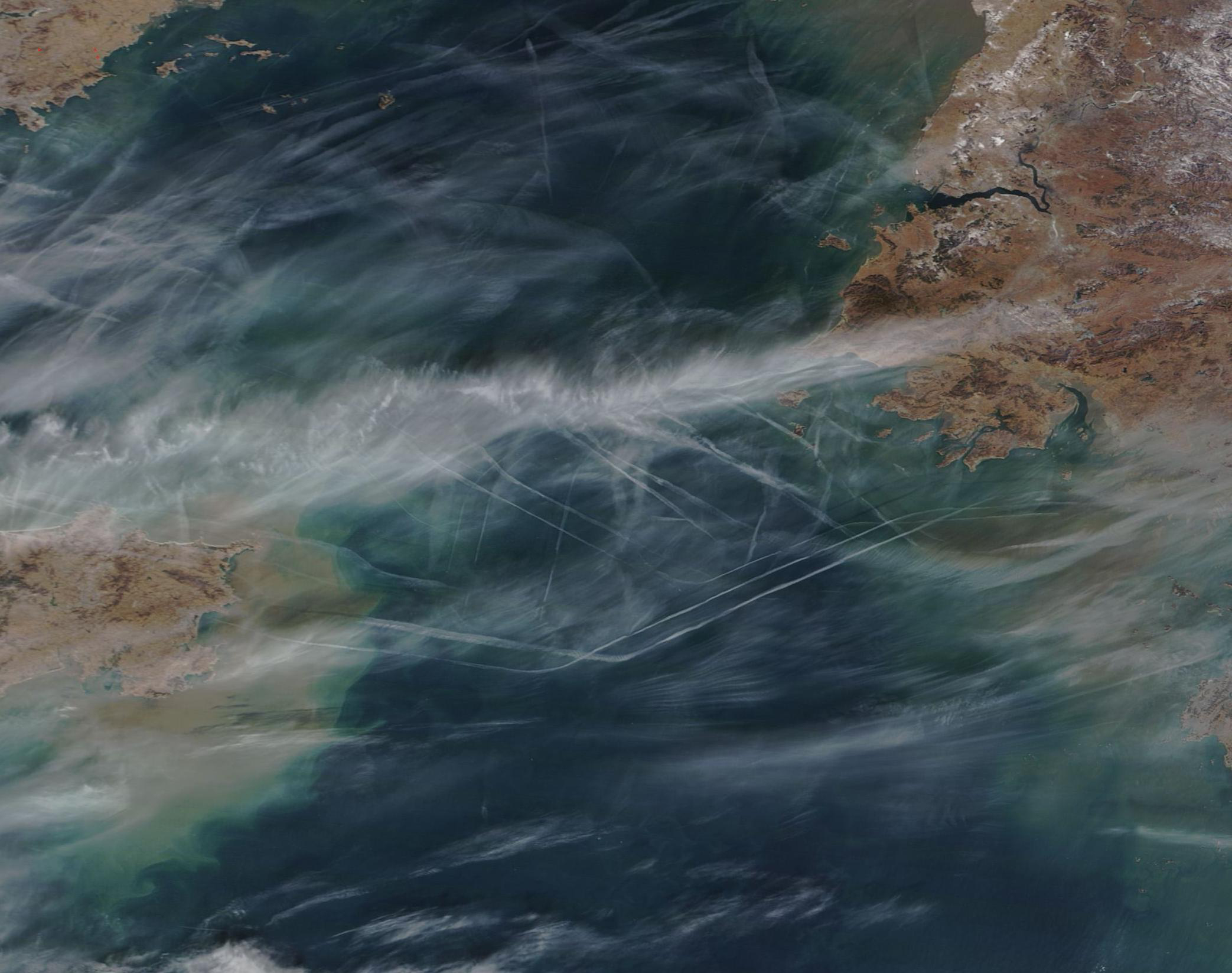
English: The numerous types of clouds that grow and move around Earth are constantly shaped by the atmosphere, land, and ocean. They can even be shaped by human activity.
Condensation trails, or contrails, are a type of cloud that forms in nearly the same way as naturally occurring cirrus clouds. At high altitudes, where it’s cold enough—at least -39°C (-38°F)—water vapor can easily freeze onto small particles in the atmosphere and form clouds. When the phenomenon involves particles from the exhaust of aircraft, the resulting long, narrow cloud is categorized as a contrail. On January 24, 2020, the Moderate Resolution Imaging Spectroradiometer (MODIS) on board NASA’s Terra satellite acquired a true-color image of the skies over the Yellow Sea. The atmosphere in this region often wears a veil of haze and cloud. On this particular day, the colors of sediment in the blue water, sweeping strokes of cloud across the sky, especially between China (east) and North Korea), and haze created a complex scene. And the picture became even more complex with numerous contrails crisscrossing the sky over the Yellow Sea. Each contrail marks the passage of an aircraft in the busy skies. Many of the contrails are parallel, suggestive of a common flight path. The numerous angles speak to the number of flight paths used by planes to travel to various destinations. The pair of long contrails that line up roughly on an east-west axis may well be made from planes traveling between China’s Weihai airport and Seoul, South Korea. Multiple parallel lines situated on a northwest-to-southeast axis may well be marking the path of planes leaving from Dalian Zhoushuizi International Airport. Dalian is located in Liaoning Province China, close to the land visible in the northwest corner of the image. |
||
| Date | Taken on 2 January 2020 | ||
| Source |
Contrails over the Yellow Sea (direct link)
|
||
| Author | MODIS Land Rapid Response Team, NASA GSFC |

 |
This media is a product of the Terra mission Credit and attribution belongs to the mission team, if not already specified in the "author" row |
Licensing

|
This file is in the public domain in the United States because it was solely created by NASA. NASA copyright policy states that "NASA material is not protected by copyright unless noted". (See Template:PD-USGov, NASA copyright policy page or JPL Image Use Policy.) |  |
 |
Warnings:
|
File history
Click on a date/time to view the file as it appeared at that time.
| Date/Time | Thumbnail | Dimensions | User | Comment | |
|---|---|---|---|---|---|
| current | 03:21, 17 February 2024 | | 2,086 × 1,647 (680 KB) | wikimediacommons>OptimusPrimeBot | #Spacemedia - Upload of http://modis.gsfc.nasa.gov/gallery/images/image01262020_250m.jpg via Commons:Spacemedia |
File usage
The following page uses this file:



.jpg)
.jpg&action=edit&redlink=1)
.jpg)



.jpg)
.jpg)
.jpg&action=info)
